Palm Beach Schools enhances security with GeoComm GIS mapping and SaferWatch Command Center
Palm Beach County School District, the nation's tenth-largest school district with over 190,000 students, is taking a major leap forward in campus safety.
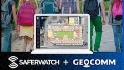
The district announced today that GeoComm's GIS advanced emergency response mapping technology has been fully integrated into the SaferWatch Command Center platform and the SaferWatch mobile application for use by Palm Beach County Schools and Palm Beach County 911. This integration will enable access to detailed digital building layouts for schools, giving first responders and school safety personnel situational awareness during emergencies.
By combining GeoComms's precise digital mapping technology with SaferWatch's comprehensive safety platform, Palm Beach County is taking a proactive step in ensuring faster, more coordinated emergency responses and, ultimately, increasing school safety.
Palm Beach County is one of the largest counties in the State of Florida to implement and comply with House Bill 301. The focus of HB-301 is to provide emergency responders with school mapping data in a digital format. GeoComm's GIS data-driven maps not only contain the school's layout but also critical life-saving public safety points of interest, like AEDs, first aid kits, fire extinguishers, utility cut-off valves, and building entrances and exits that aid in rapid responses.
Emergency Response Mapping in Critical Incidents
The moment an emergency is reported at a school within Palm Beach County, the alerts are instantly sent to SaferWatch's Command Center platform, allowing more than 17 law enforcement agencies and 911 centers to coordinate and communicate the response on a single platform. Whether it is a SaferWatch Mobile Panic Button, a Raptor Alert, or a Centegix CrisisAlert badge that is activated, dispatchers and school police can now instantly see the precise location of the incident on an up-to-date, highly detailed map—all within the SaferWatch Command Center platform at the 911 center.
"The immediate access to accurate school maps with detailed points of interest allows first responders to have a clear picture of our school campuses before they arrive on scene," said Sarah Mooney, Chief of Police, Palm Beach County School District Police Department. "In addition to facilitating an efficient response to an identified location on campus, the accessibility to the advanced maps allows incident commanders the ability to manage campus incidents with a full picture of the campus landscape. When the nuances of the campus are readily visible, it supports the opportunity to respond to an emergency in the safest and most efficient manner."
Key features of the integration include:
-
Access to Building Layouts: First responders can view school floor plans the moment an alert or call is received.
-
Room-Level Detail: Details include clearly marked building interiors with room numbers and names, entry and exit points, and the locations of emergency assets like defibrillators and cameras to give first responders pinpoint accuracy when seconds matter most.
-
Unified Platform: School safety teams and 911 dispatchers share the same live information via SaferWatch Command Center.
-
Dynamic Updates: Incident updates are reflected in real time, allowing responders to quickly adjust tactics as situations evolve.
"We're very excited to see Palm Beach County leading the way in school safety innovation. The GeoComm-SaferWatch integration represents what's possible when technology, data, and public safety come together to enhance on-campus emergency response," said Bill McCullough, VP of Sales & Marketing at GeoComm.
This integration builds on the powerful suite of features already offered by SaferWatch, including:
-
Mobile Panic Alerts that immediately notify law enforcement and emergency responders.
-
Mass Notification System to quickly inform staff, students, and parents of critical updates.
-
Anonymous Tip Reporting to encourage early intervention before emergencies escalate.
-
Two-Way Communication between emergency reporters and law enforcement for real-time information sharing.
-
Incident Management and Incident Response within the SaferWatch Command Center.
"This integration represents a major advancement in school safety and 911 technologies. By combining SaferWatch's real-time communication and alerting capabilities with GeoComm's detailed building mapping, we're giving Palm Beach County's schools and first responders the tools they need to respond with precision and speed. It's about closing gaps and delivering critical information when every second counts," said Geno Roefaro, CEO of SaferWatch.
A Common Operating Picture for Critical Incidents
With this integration, Palm Beach County's schools and emergency services share a common operating picture throughout an incident. Telecommunicators at the county's Emergency Communications Center and school administrators using the SaferWatch Command Center are both working from the same visual data.
"Having the indoor location data available immediately allows the school district police and local police to coordinate their response with a common operating picture and inter-agency communication available within the SaferWatch portal," said Daniel Koenig, Senior Manager-911 for Palm Beach County Public Safety Department
This forward-thinking partnership reflects Palm Beach County's unwavering commitment to student and community safety, leveraging cutting-edge technology to ensure that help arrives faster and with greater precision.
